Site blog
|
|

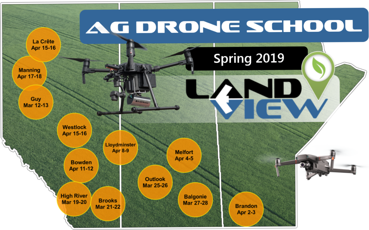
REGISTER TODAY
- Press | UAS Vision Mitsubishi Hitachi Power Systems, Ltd. (MHPS) is putting into practical service unmanned aerial vehicles (UAVs) to more easily and efficiently inspect the interiors of power plant boilers and other large indoor structures. Demonstration testing for manually operated drones was completed last year, and MHPS plans to begin offering the inspection service from April 2019.
MHPS is also pursuing development of autonomous UAVs, together with research and development firm A.L.I. Technologies Inc. Basic technology verification tests were conducted using a prototype device, and were completed last year. MHPS’ production of the device and practical application is planned for fiscal 2020. The aim is to facilitate shorter downtimes of facilities, longer periods between regular inspections, and a quick and appropriate response to emergencies.
Manually operated UAVs used to inspect the inside of power plant boilers and other structures, will utilize MHPS’ collision and environment resistant technologies, and have been under development since fiscal 2016. The test demonstration in December of 2018 was conducted with the support of Mitsubishi Heavy Industry’s Research & Innovation Center, and the use of actual test facilities and boilers.
Autonomous UAVs purposed for inspections, have been jointly developed by MHPS and A.L.I. Technologies since fiscal 2017, using multiple test boilers and mockups of actual boiler environments. Basic technology verification tests conducted in September of 2018 confirmed the capability for autonomous flight without using GPS or other satellite positioning systems.
The practical application of UAVs using satellite positioning systems is already well advanced, but operational technologies in special environments, such as the inside of boilers, have yet to be established, making practical application a breakthrough technology.
A.L.I. Technologies’ business scope consists predominantly of drone-related applications and edge computing technologies.
MHPS, by developing drone-enabled power plant inspection technologies and providing advanced after-sales services for power generation facilities, will further enhance stable energy supplies and contribute to global economic development, while lessening the environmental load.
BY MARCUS WEISGERBER GLOBAL BUSINESS EDITORLifting an idea from the Army and a name from the Star Wars universe, the U.S. Navy is assembling a team of engineers, researchers, and even hackers to develop ways to fight off swarms of cheap commercial drones.
The so-called JYN effort is the latest in a series of steps the Pentagon has taken to speed up development of new systems that can defend against drones that are readily available for purchase and easily modified for war..
“This is necessary to enable the [Navy] to gain a competitive advantage over the commercial advancement of unmanned systems technology and potential for nefarious use against [Navy] facilities and assets,” James “Hondo” Geurts, who leads Navy acquisition, wrote in a March 28 memo.
Navy officials are working with the Defense Digital Service to create a “team of highly technologically skilled and driven military and civilian…personnel” to work “in collaborative, startup-like spaces to rapidly develop new [counter-drone] products to address the evolving [drone] threats,” Geurts wrote.
The project expands the Defense Digital Service’s “successful efforts forming, training, and managing joint-service and Army teams,” he wrote.
The Defense Digital Service’s Army counter-drone project is called Jyn Erso after the character in the Star Wars film Rogue One.
Sailors, Marines, and Department of the Navy civilians can apply for the positions on the counter-drone team. Specifically, they are looking for “software engineers, hardware engineers, hackers, security researchers, and other military and civilians with outstanding technical abilities,” Geurts wrote.
“This is an opportunity to grow the talent within the organization, leverage top technologists, learn new approaches, and bring them back to the [Navy],” he wrote.
The new announcement isn’t the first time that the Navy has sought ways to protect ships from swarms of small drones. In 2014, the Navy deployed a 30-kilowatt laser called the XN-1 LaWS aboard the amphibious transport dock Ponce in the Persian Gulf and released test footage of the laser shooting down a ScanEagle drone. Navy officials liked the idea of fending off enemy drone swarms with a laser that costs about a dollar per shot rather than $750,000 Standard missiles. The Navy bought two more of the lasers at $150 million each, with deployments scheduled for FY 2020.
Islamic State militants in Iraq and Syria have weaponized small commercial drones, rigging them with explosives. Last year, a drone was reportedly used in an assassanation attempt on Venezuelan President Nicolás Maduro.
Even unarmed drones can cause chaos, particularly if struck by aircraft traveling at high speeds. In recent months, authorities have shut down major airports in London, Dubai, and Newark after small drones were found in the area.

From Checkpoint,Maja Burry, Rural reporter, Simon Rogers, Video journalist
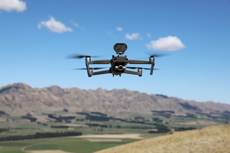
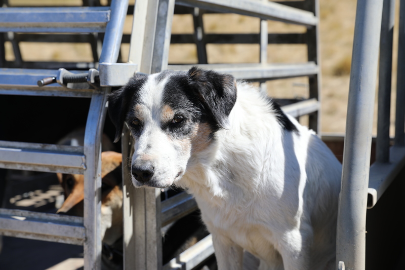
Robots aren't just stealing human jobs, they're after man's best friend too - now there's a drone that can bark like a sheep dog.
The latest drone developments come as more farmers have started using the technology for work on the farm in recent years.
Drone specialist from Christchurch-based DJI Ferntech, Adam Kerr, said the uptake in drones for agricultural uses had now made the National Agricultural Fieldays in Hamilton one of the biggest events in the company's calendar.
"The past two years have seen farmers embrace drone technology to help with those jobs that are dirty, dangerous or just plain dull," he said.
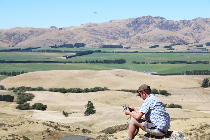
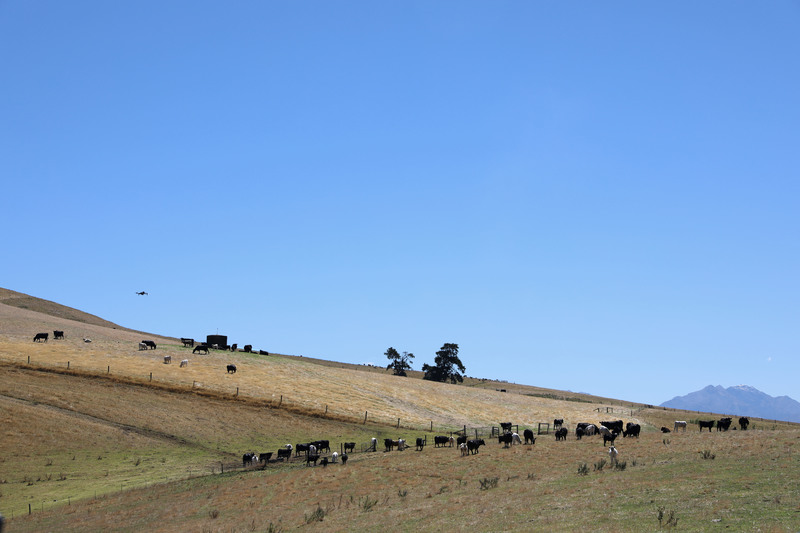
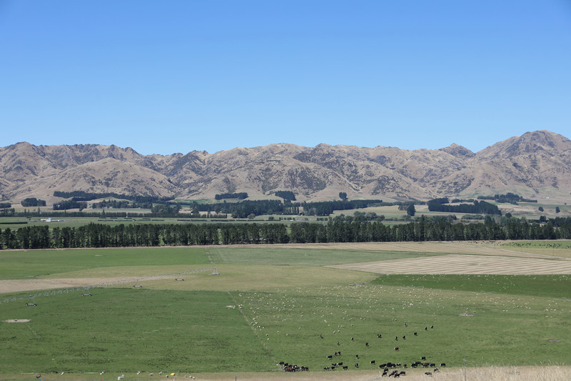
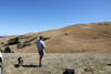
Corey Lambeth, a shepherd on a North Canterbury sheep and beef farm near Rotherham, said his drone had made work such as moving stock and checking water and feed levels more efficient.
"Winter time it's ideal for flying it sitting at home on a cold day I don't want to go outside, so I fly my drone round, have a look make sure all my stock are behind the wire.
"Also when we're lambing we can fly it round, it's ideal with the [camera] zoom, going right in, looking at it [the drone monitor], not even disturbing the ewes," Mr Lambeth said.
Corey Lambeth using the drone. RNZ / Simon Rogers
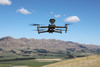
The latest drone model, the $3500 DJI Mavic Enterprise, can record sounds and play them over a speaker - allowing a dog's bark, or other noises, to be loudly projected across a paddock.
Mr Lambeth said this feature helped move stock along faster during mustering while stressing the animals less than a dog could.
Cows could sometimes become protective of their calves and try to lunge at farm dogs when they got too close, he said.
"That's the one thing I've noticed when you're moving cows and calves that the old cows stand-up to the dogs, but with the drones, they've never done that," he said.
Mr Lambeth said while some farmers might consider it lazy, a drone could save them time and money.
His employer, fourth generation farmer Ben Crossley, bought a drone after seeing how Mr Lambeth was using his for day-to-day work on the farm.
Mr Crossley said while some farmers struggled with the new technology, it was important to keep up.
"Just trying to get efficiencies too, to just save time, it can sometimes take half a day to find a water leak, whereas with a drone you can zip around and have it done in an hour at the longest," he said.
"I used to go an see my grandfather every night, he lived on the farm, and he used to even struggle with cellphones, so yeah, a drone would be a shock for him," Mr Crossley said.
While drones were a new part of the farming tool-kit, Mr Lambeth said technology could sometimes let you down, especially in trying weather conditions.
"With real severe wind and that, you couldn't fly a drone in it [and] with the rain as well, which I'm sure they'll be making developments on to make it more durable in winter time ... but that's when you'd use the dog on wet days," he said.
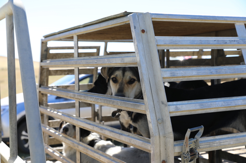
Mr Lambeth said he had no plans to start leaving his five dogs at home when it was time to go to work.
"There's definitely going to be places for dogs always on farm, the one downside of the Mavic [drones] or anything electronic is you still need to bring them in and charge them," he said.
The life span of a drone could not compete with 10 years of well look after dogs, Mr Lambeth said.
The barking drone, the Mavic 2 Enterprise. RNZ / Simon Rogers

RNZ / Simon Rogers

RNZ / Simon Rogers
RNZ / Simon Rogers
RNZ / Simon Rogers
RNZ / Simon Rogers

RNZ / Simon Rogers

Waiau River in North Canterbury. RNZ / Simon Rogers
RNZ / Simon Rogers


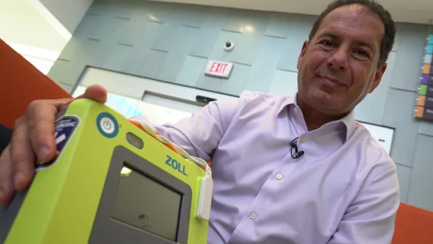
Michael Smee - CBC News Research shows drones can cut down response times 6 minutes in urban centres and 10 minutes in rural centres. Dr. Sheldon Cheskes with one of the talking defibrillators that can be carried to emergency scenes via drone. (Grant Linton/CBC)
Peel Region councillors will hear a pitch later today from a doctor who wants to add a new component to their emergency response fleet: defibrillator-carrying drones.
Dr. Sheldon Cheskes, medical director at the Sunnybrook Centre for Prehospital Medicine, said drones can beat fire trucks and ambulances to the scene of a cardiac arrest, and that could be a life-saving difference.
"Our research shows when we set up drones we can cut down response times six minutes in urban centres [and] almost 10 minutes in rural centres," Cheskes said.
"So if I can cut down 10 minutes in a response time in a rural area, we can make a big difference potentially to saving lives. It may be futuristic but it makes sense from a logistics point of view."
He said his model would involve equipping some ambulance stations with drones that are fitted with automated external defibrillators, also known as AEDS. When a 911 call comes in for a cardiac arrest victim, a defibrillator-bearing drone would be dispatched, along with fire and ambulance crews.
 A diagram showing how defibrillator-bearing drones could change the way emergency services are delivered. (Region of Peel )
Bystanders would be instructed through a recorded voice in the defibrillator how it should be used.
"That's the beauty of it because we know that when bystanders provide shocks through defibrillation the chance of survival is almost four times more than if we wait for EMS to get there," he said.
Other jurisdictions in the U.S. and Europe have tried similar systems, he said, but "we're the first ones in the world to actually try to implement this as part of an EMS response."

Mississauga Mayor Bonnie Crombie said her community is always looking at ways to improve access to AEDs. (Mehrdad Nazarahari/CBC)
Cheskes said he's not sure how much the system would cost to implement and run.
As for the web of regulations that control drone use in urban areas, he said he's confident drone companies contracted by municipalities would know how to operate within the rules.
Even so though, he said the current system probably couldn't work within built-up areas like downtown Toronto.
More research needed
"The issue in a really urban centre, with lots of high rises, is that the technical parts are very difficult because of wind shear," he said.
Cheskes said he's hoping the Region will agree to do more research on the idea, to determine how feasible it could be.
Mississauga Mayor Bonnie Crombie wouldn't speak to CBC Toronto on camera. But in an email, she called the idea "interesting."
"I agree that we need to explore innovative ways to get life-saving technology, including AEDs, in the hands of the people who need it, when they need it," she wrote.
"The Region of Peel has a successful community PAD/AED program that has placed hundreds of AEDs in public places. We are always looking at how we can improve access, response times, success rates and confidence with the public in operating these devices. I look forward to hearing Dr. Sheldon Cheskes proposal at Regional Council."
BY SUSAN MILLER The Army's Engineer Research and Development Center wants to put radar systems that identify environmental phenomena on unmanned aerial and ground vehicles so they can be used to survey previously inaccessible locations and cover more territory from the air.
Currently, ground-penetrating radar systems are large arrays mounted on the front of military vehicles to detect improvised explosive devices. Smaller commercial versions exist as well.
Ground penetrating radar has non-military uses as well; it is currently being used to find cracks and corrosion in pavement. The Robotics Assisted Bridge Inspection Tool – a Volkswagen Beetle-sized robotic machine has been tested by the Federal Highway Administration’s Office of Bridges and Structures. It has also been used in Haymarket, Va., to assess the condition of bridge decks.
Ground-penetrating radar devices have not yet been mounted on small unmanned systems, however, primarily because of size, weight and power constraints. The Army wants the radar-on-a-chip technology to deliver a digital map that shows the shapes, sizes and features of objects in the environment.
Contractors will be asked to collect data on inert unexploded ordinance (UXO), synthetic tracer material and flora and fauna using radar on a chip operating between 100MHz and 5GHz attached to an unmanned system. The objects of interest may be buried, unburied or partially buried in a 20-square-meter area at the Army's Engineer Research and Development Center in Vicksburg, Miss., consisting of flat, sloping, underground, indoor and vertical terrain.
The success of the program would alleviate some of the limitations of traditional ground-penetrating radar technology for UXO detection, improve mapping of tracer material and better identify flora and fauna.
In 2018, the Army Research Lab worked with researchers at the University of Delaware on a system that combines traditional cameras, thermal infrared sensing and ground-penetrating radar that probes the surrounding environment, spotting objects buried up to three to five inches. The multi-camera system could be deployed on autonomous vehicles, drones or robots before troops are sent into an area.

Farai Sevenzo and Anna Cardovillis, CNN Drone footage by Lewis Whyld, CNN Tica, Mozambique (CNN) It has been nearly two weeks since Tropical Cyclone Idai ripped through Mozambique, razing buildings and submerging entire towns and villages -- but even now the human toll is yet to be fully understood.
The Category 2 storm -- which made landfall in the early hours of March 15 with 175 kph (110 mph) winds and heavy rains -- has devastated this southern African country.
Driving away from the airport in Beira, a port city that bore the brunt of the cyclone, it was impossible to escape the sight of debris. As the rain eases, residents are emerging to surveying the ruins that remain and begin their clean-up efforts.
Factories have been ripped clean apart while the entire aluminum roof of a school building was hanging precariously.
Nothing in Beira -- from the cathedral to restaurants, banks and the port, where the cyclone dislodged shipping containers -- escaped Idai's wrath.
From affluent homes built in eye-catching Portuguese colonial style to more modest properties, the tropical cyclone took something.
Telecom masts, satellite feeds and the internet all bowed to its force. The overall effect was that Idai knocked this thriving port city into a pre-digital world.
Yet it's not until you leave Beira that the cyclone's destructive powers are really exposed.
On the road to Tica, around 80 kilometers (49 miles) from Beira's beaches, drone footage revealed massive tracts of waterlogged land and huge trees snapped like twigs.
This road into the interior of Mozambique should lead all the way to Zimbabwe with the sea firmly in the rear-view mirror.
Instead, the huge swathes of inland water that are visible from space greet motorists.
For so many, these waters have taken over their lives. Farmers' crops have disappeared, and their livestock are left to wade through the murky waters in search of somewhere to graze.
Complicating the situation further, the flooding will not clear away anytime soon as rains have continued to fall.
The new homeless are left with no choice but to trudge through the waterlogged landscape towards hastily improvised shelters.
More than half a million people have been affected in the country and at least 110,000 have sought refuge in camps.
Meanwhile, the humanitarian efforts to reach those trapped continue but collapsed roads are hampering progress.
With no other option, some people are using rudimentary canoes to cross the flooded plains while others are trudging across higher ground to safe havens several hours walk away.
One eyewitness told CNN that in areas where flood waters were still high, people were joining hands to form human chains.
Mozambique's Minister of Land and Environment, Celso Correia, said over the weekend that 446 people have now been reported dead in the country. But aid agencies say it is premature to say how many people have been killed while some affected areas remain inaccessible.
Many are wondering at what might come in the next few days in this heady mixture of undiscovered dead, stifling heat and flooded land.
Eyewitnesses have given ghastly accounts of corpses. One described seeing 300 to 400 bodies wash up on a flooded stretch of road just north of Tica.
Mozambican President Philippe Nyesi has called this "a disaster of great proportions," and its full extent is yet to be truly realized.
Farai Sevenzo and Anna Cardovillis reported from Mozambique. Lauren Said-Moorhouse contributed to this report
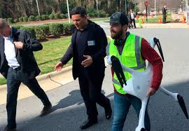
By JONATHAN DREW . Matternet CEO Andreas Raptopoulos walks next to an operator carrying a drone used for delivery of medical specimens after a flight at WakeMed Hospital in Raleigh, North Carolina on March 26, 2019. Matternet and UPS partnered with the hospital to start commercial flights of medical samples across the WakeMed campus.
RALEIGH, N.C. -- A pioneering use of drones to fly blood samples across a North Carolina hospital campus launched Tuesday in the latest move to expand their roles in business and health care.
The short trips between WakeMed buildings in Raleigh mark the first time the Federal Aviation Administration has allowed regular commercial flights of drones carrying products, according to UPS and drone company Matternet, which partnered with the hospital on the program.
"This is a turning point, and it's an historic moment because this is the first FAA-sanctioned use of a (drone) for routine revenue-generating flights," Bala Ganesh, vice president of UPS' advanced technology group, said in an interview before the announcement.
The FAA confirmed in a statement Monday that it hadn't previously allowed drones to make routine commercial package deliveries, known as revenue flights. Others have flown drone deliveries as part of smaller-scale tests or demonstrations.
The WakeMed program will start by flying patients' medical samples one-third of a mile (.5 kilometer) from a medical park to the main hospital building for lab testing at least six times a day five days a week, Matternet CEO Andreas Raptopoulos said in an interview. Vials of blood or other specimens will be loaded into a secure box and carried to a drone launching pad, where they will be fastened to the aircraft and flown to another building. He said the flights will technically be within sight of operators on either end of the route, and they are authorized to fly above people.
The aim is to cut down on the time it takes to transport the time-sensitive samples typically driven on the ground.
"This is going to bring tremendous benefit to health care," he said in an interview. "Health care is one of these domains of commercial activity where being fast really matters."
The announcement doesn't mean routine physical checkups this year or next will feature unmanned aircraft whizzing into your internist's office to speed along your cholesterol results, experts say.
But the North Carolina program could expand to flying miles-long routes between Raleigh-area WakeMed buildings in the coming months, Raptopoulos said. He also said medical specimen flights could start at one or two more hospitals in other cities later in 2019.
North Carolina is one of nine sites participating in the FAA's pilot program to accelerate integrating drones for new uses ranging from utility inspections to insurance claims. The test sites get leeway trying new innovations while working closely with the federal officials in charge of regulating the drones.
At other program test sites, drone operators recently delivered ice pops to doorsteps in a Virginia neighborhood, and officials in Reno, Nevada, are in early testing of a program to deliver defibrillators to people having health emergencies.
The Nevada defibrillator project has so far been testing at a rural site and hasn't begun home deliveries, said Rebecca Venis, the city's communications director. The approval process for drone flights of medical devices or supplies is complex because they may contain hazardous materials.
"It's different than dropping a package," she said.
Mark Blanks, the director of the Virginia Tech Mid-Atlantic Aviation Partnership, also said the approval to fly commercial drones can be a significant achievement.
"It's not a safety piece; it's an economic licensing portion," he said.
Colin Snow of the drone research firm Skylogic said it remains to be seen how cost-effective medical drone deliveries will be. He said regulatory hurdles and the significant costs of establishing the programs could hinder their wide rollout across the country.
"It just goes down to the old adage: Just because you can, doesn't mean you should," he said. "They're cool, headline-making tests. But when you get down to ... the economics of logistics, that's a different matter."

Posted By: Miriam McNabb The FAA and U.S. DOT have clarified the travel policy for LiPO batteries – something that drone flyers need to know before traveling.
Batteries
Lithium ion batteries do carry a risk of fire – incidents reported to the FAA show that some problem comes up at least a couple of times a month. But as it may be more difficult for an airplane crew to deal with a fire when it is in the cargo hold, passengers are required to carry the batteries with them in the cabin.
“This rule will strengthen safety for the traveling public by addressing the unique challenges lithium batteries pose in transportation,” said U.S. Secretary of Transportation Elaine L. Chao.
“This IFR prohibits the transport of lithium ion cells or batteries as cargo on passenger aircraft. In addition, the IFR requires lithium ion cells and batteries to be shipped at not more than a 30 percent state of charge aboard cargo-only aircraft,” says the DOT notice.
The full text of the interim final rule (IFR) can be downloaded here. The critical points for drone operators are:
(1) prohibits the transport of lithium ion cells and batteries as cargo on passenger aircraft; (2) requires lithium ion cells and batteries to be shipped at not more than a 30 percent state of charge aboard cargo-only aircraft when not packed with or contained in equipment; and (3) limits the use of alternative provisions for small lithium cell or battery shipments to one package per consignment.
The interim rule issued on February 27 was mandated by theUnited Nation’s International Civil Aviation Organization for all member countries in 2016.
In addition to obeying the regulations and carrying your batteries with you in carry on baggage, there are a few other pointers that will make traveling with your drone easier.
Regulations
Make sure you understand the regulations in your destination country or state: and if you are traveling for work, you may want to ask your employer for help with this. You can find state regulations here; but local regulations can be hard to track down without contacting the city or park regulators directly. Regulations for other countries may also require research – you should definitely spend some time on forums and websites to figure them out before you go. Some countries may require your drone to be registered in advance of your visit.
Packaging
Avoid breakage by packing your drone in an appropriate case. It’s worth the investment in a travel case designed for your drone to protect your purchase – and save you from the hassle of repairs on site. Keep it inconspicuous: those designed to look like ordinary backpacks or briefcases may prevent your drone from being targeted for further examination.
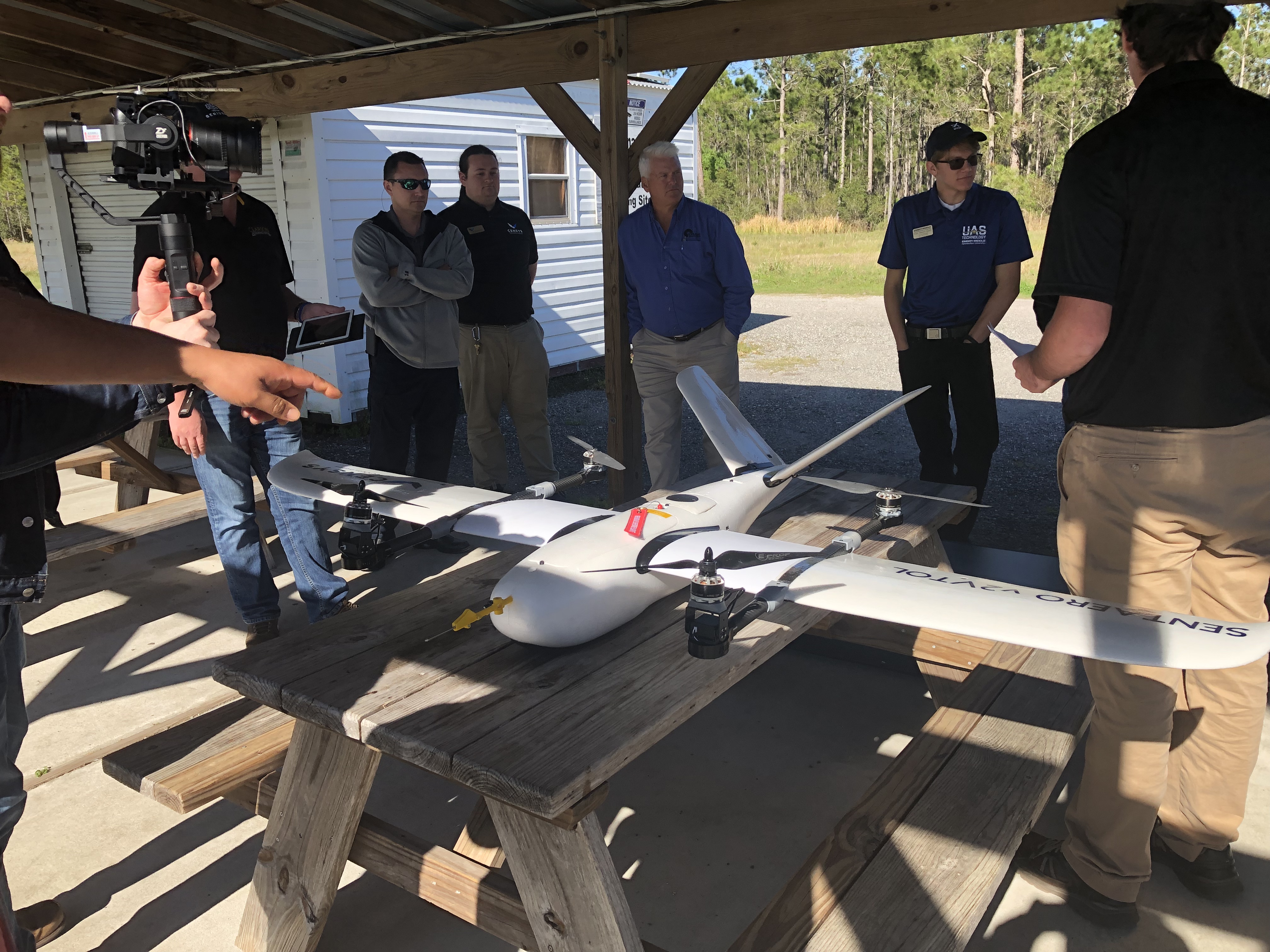
Censys Technologies is a company that helps companies.
At Clarion we are proud to be working with Trevor and his team.
When relationships matter, there is no other go to for VTOL and BVLOS