Site blog
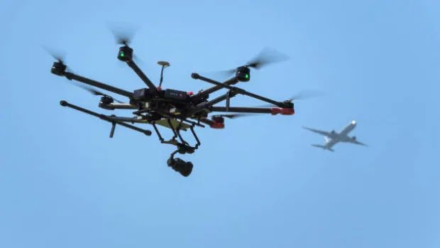
he number of mid-air conflicts between drones and crewed aircraft rose in the first half of this year in most parts of Canada, with Ontario leading the way by far, according to new statistics obtained by CBC News.
Transport Canada says between Jan. 1 and June 30, there were 33 "incidents" between drones and airplanes in Ontario's skies. During the same period in 2018, there were 24, and 25 in the first six months of 2017.
Transport Canada defines an incident as a conflict between a crewed aircraft and a drone that "poses a risk to aviation safety."
"More drones are flying, so there's more probability that incidents could be reported to the department," said Ryan Coates, manager of Transport Canada's remotely piloted aircraft systems task force. "They've just increased in numbers by the thousands."
During the same time period, the number of drone-airplane conflicts has risen in other regions across Canada, with the exception of Quebec, where they've dropped since the first half of 2017, from 11 incidents to six this year.
Even so, there has only been one case of a drone striking a crewed aircraft, according to Coates.
- In late 2017, a passenger plane and a drone collided over Quebec's Jean Lesage airport. There were no injuries and the plane landed safely.
- In November 2016, two flight attendants were injured when a Porter Airlines flight dove suddenly on its approach to Billy Bishop Toronto City Airport.
"The crew observed a 'drone' type object on a collision course with the aircraft," the captain reported in documents obtained under a freedom of information request. "The object was described as: solid, dark, about 5-8 feet in diameter, and shaped like a doughnut."
 This chart shows the number of reported drone incidents posing a risk to aviation safety, region by region. (Transport Canada)
Emails between employees at Porter Airlines and Transport Canada investigators speculate the object could have escaped from a U.S. military base near Watertown, N.Y., where "they launch and test-fly drones." Ultimately, the object was never positively identified.
Mike Smee - CBC News
Automatic Drone Charging In Outdoor Environments
Berlin, Germany, August 9, 2019 — Skysense today announced the launch of its long-awaited new High Power Outdoor Charging Pad product line.
After months of testing and the first successful deployments in Norway and Finland, Skysense today announced the launch of its new High Power Outdoor Charging Pad product line.
The autonomous charging station has been engineered as a turnkey solution that works out of the box. It is made of a weatherproof inox steel landing platform and an added payload of only 45 grams.
The system boasts 500W of power at a consistent 92% efficiency making it by the fastest and most lightweight turnkey solution for automatic drone charging on the market.
Skysense Outdoor Charging Pad features a rugged stainless steel conductive platform which has been designed to be permanently installed Outdoors, ensuring functionality in wet and harsh environments.
The company states that its proprietary Wired Charging Technology, charges the drone batteries at the maximum allowed charging rate:
“When a drone land on a wireless charging platform, it is very difficult to predict how long is going to take to recharge since the landing accuracy heavily affects the wireless charging efficiency. Skysense Wired Charging Technology is reliable and the company decided to be the first company to guarantee charging times of one (1) hour for LiPo batteries up to 10,000mAh.”
For the following three weeks following this announcement, you may take advantage of Skysense’s promotional offering granting 20% discount off all Outdoor Charging Pad product line. If you would like to secure your discount, you may contact Skysense through their website:
https://www.skysense.co/contact-us
About Skysense
Skysense is a Qualcomm Ventures-backed startup building charging stations for NASA, enterprises, and startups, operating autonomous drones in the security, inspections, agriculture, and logistics markets. More information can be found on the company’s website: http://www.skysense.co
By Press
The U.S. Air Force selects Ascent Vision Technologies to provide a full suite of counter drone vehicles.
Bozeman, Montana – Ascent Vision Technologies (AVT) was recently awarded a contract to deliver a full suite of counter-drone vehicles to the U.S. Air Force. This unique capability, known as the eXpeditionary Mobile Air Defense Integrated System or X-MADIS, was selected by the Air Force after 18 months of testing, trials, and evaluation across multiple military services and operational spectrums. The total contract value exceeds $23mm and deliveries will begin later this year.
The mission of the X-MADIS is to detect, locate, track, identify and defeat small unmanned aerial systems (sUAS) by combining the capabilities of radar, optics, radio frequency detection and electronic command and control mitigation of the aircraft. The X-MADIS is unique in that it accomplishes the mission while the unit is static or on-the-move.
This most recent contract award was the latest step in a three-year run for AVT’s expansion into Counter UAS (CUAS) operations and its dedicated research, development, testing and fielding of purpose-built CUAS components and integrated systems. AVT was founded and led by combat veterans of the US military and its focus remains the survivability of deployed service members.
In the past 2 years, worldwide incidents of negative drone-related activity have exploded from combatants using commercial off-the-shelf drones on the battlefield, to the intentional disruption of civilian airports. During the last 24 months, AVT has been awarded over $60 million in product and service-related contracts in support of multiple anti-drone initiatives for the US and allied militaries.
Recently, a variant of the MADIS family of systems, the L-MADIS which in use by the USMC, downed an Iranian drone in the Persian Gulf as it harassed a US Navy vessel. This was the latest event in an 18-month series of successful MADIS deployments in which it successfully countered enemy UAS in theatre.
“We are honored that the U.S. Air Force selected X-MADIS to combat the increasing threat of nefarious UAS activity against our military. The safety, security and survivability of our Airmen is paramount in the current UAS threat environment,” said Lee Dingman, President and Chief Commercial Officer for AVT.
AVT CEO Tim Sheehy added, “With the growing threat of weaponized sUAS employed on the modern battlefield, the need for effective and reliable counter UAS technology is crucial.
We are proud to have our technology ready to protect our Airmen from insidious sUAS attacks.”
The defense team of W. S. Darley & Co. (Itasca, IL – aka “Darley Defense”) was instrumental in shepherding the contract process for this award.
About Ascent Vision Technologies (AVT)
AVT specializes in innovative systems for counter UAS; air defense; ISR (intelligence, surveillance, and reconnaissance); and target acquisition for the defense and aerospace industry. AVT is a world-leading provider of CUAS solutions. The X-MADIS, eXpeditionary Mobile Air Defense Integrated System, is a proven fully integrated solution that detects, locates, tracks, identifies and defeats sUAS for fixed site and on-the-move mission. AVT
designs and manufactures high-performance, multi-sensor, gyro-stabilized imaging systems for airborne, ground and maritime domains, which are fielded in over 50 countries.
For more information on the X-MADIS system visit:
https://ascentvision.com/integratedsystems/
By Press
Professional users of prosumer-grade UAVs can now hover and land their drones precisely – for drone-in-a-box, autonomous charging, indoor operations, remote inspection missions and many other commercial use-cases.
Precision landing i.e. the ability to accurately land a drone on a landing platform has until now been available mainly for commercial-grade drones – particularly those running Ardupilot or PX4 autopilots. However, FlytBase now brings this powerful capability to prosumer grade drones (eg. the DJI Mavic and Phantom series, including all variants) that are SDK-enabled.
Fully autonomous precision landing is best delivered via a vision-based approach that leverages the inbuilt downward-looking camera and intelligent computer vision algorithms while avoiding the need for external sensors, cameras, and companion computers. The ability to configure and manage this capability over the cloud in real-time, customize the visual markers, and integrate with the ground control station makes it well suited for enterprise drone fleets.
Furthermore, commercially beneficial drone missions need the ability to land the drone precisely on any target location of interest or importance – not just on the home location. In fact, regardless of the landing location, there also needs to be a closed-loop that checks and ensures that the drone did indeed land precisely where intended.
Precision landing can be further complicated due to operations in environments with weak or no GPS signals (such as dense urban areas with tall buildings, warehouses, retail stores, etc.), or landing on moving platforms. FlytDock enables the UAV to accurately loiter and land in such scenarios, including night landings and low light drone operations.
For long-range, long-endurance, repeatable, BVLOS missions, customers need to deploy fully autonomous drone-in-a-box (DIAB) solutions, which require the drone to take-off, hover and land very accurately – along with automatic charging, environmental protection and remote control. The challenge is that existing DIAB offerings are overpriced to the point where production deployments are commercially unviable. The good news for customers is that prosumer drones are rapidly maturing along the technology S-curve, and are available at extremely compelling price points – thus driving enterprise DIAB solutions towards off-the-shelf drone hardware coupled with intelligent software that is built on an open architecture with APIs, plugins and SDKs. This combination – coupled with 3rd party charging pads and docking stations that use precision landing technology, and a cloud-based GCS – results in an integrated, cost-effective DIAB solution, at price points potentially one-tenth of the existing drone-in-a-box products.
Indoor drone operations may not need full DIAB solutions – instead, inductive or conductive, API-enabled charging pads may be sufficient. Nevertheless, they too require precision landing seamlessly integrated into the workflow to enable autonomous charging – including the ability
and robustness to navigate in no-GPS environments. Coupled with remote configuration & control over the cloud or a local network, and fail-safe triggers, such precision landing capability can drive large-scale indoor drone deployments.
Remote asset inspections, for example autonomous inspections of wind turbine farms located in far-off rural areas, may not require BVLOS permissions if granted regulatory waivers as part of FAA pilot programs. However, the ability to takeoff and land precisely from outdoor charging
pads or docking stations is a key capability for such asset monitoring missions, which may need to be conducted weekly or monthly per regulatory / maintenance mandates. Nitin Gupta, FlytBase Director, commented,
“We continue to expand the hardware-agnostic capabilities of our enterprise drone automation platform with this latest enhancement to FlytDock. Precision landing is now available to a customer segment that has been severely under-served so far. In fact, most commercial drone missions do not need expensive, monolithic drones, and can instead be reliably executed with off-the-shelf, SDK-enabled drones. Hence, we believe it is important to make our intelligent plugins available to drone technology providers and system integrators who are building cost-effective UAV solutions for their customers.
Prosumer-grade drone fleets can now be deployed in autonomous enterprise missions – with the ability to navigate and land reliably, repeatedly, accurately.”
To procure the FlytDock kit for your drone,
visit https://flytbase.com/precision-landing/, or write to info@flytbase.com.
By Press
The Federal Aviation Administration (FAA) today introduced an update of B4UFLY, its app for helping pilots and less experienced operators ensure drone flights are safe and compliant with federal law.
The previous version of the app made it confusing at times to understand whether it’s legal to fly a drone, but the update, led by drone company KittyHawk, makes it easy to understand if it’s OK to fly with commands like “Good to Go”, “Warning”, and “Do Not Fly”, a trio meant to give users a red, yellow, or green light.
Real-time information from the FAA is also incorporated into the app, such as temporary flight restrictions near airports or stadiums as well as more permanent airspace restrictions placed on flight around critical infrastructure, airports, national parks, or military training routes.
In the future, B4UFLY will take into account factors like weather or major events like a public emergency or natural disaster.
B4UFLY is available for download on iOS and Android smartphones. More than 700,000 people have used B4UFLY since its release in 2016. Plans to upgrade the app were initially announced in late February.
Apps like B4UFLY will be crucial as airspace becomes more crowded with drones and other flying machines. The FAA is currently conducting experiments with public and private partners as part of its Unmanned Aircraft System Integrated Pilot Program (UAS IPP).
Experiments underway include drone usage to combat mosquitoes in Florida as well as food deliveries by Uber and 5G amplification by AT&T.
As part of the program, the San Diego Fire Department and Chula Vista Police Department are also deploying telepresence drones to get a view of emergency situations before vehicles on the ground can reach the scene.
In recent advances in commercial services via drones, Alphabet’s Wing began to make deliveries in Australia earlier this year and Finland this summer, while Amazon plans to begin trials of its latest Prime Air delivery drones in the coming months.
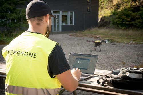
Deliveries in urban environments is by many considered to be the holy grail of the drone industry. Swedish software and drone service developer, Everdrone, just completed their first fully autonomous deliveries between two hospitals in central Gothenburg. The flight stretched 4,4 km and was made possible through a first-of-its-kind permit given out by the Swedish Transport Agency. The flight was also unique in the sense that the landing was performed in a GPS denied location between tall buildings and only made possible by Everdrone’s onboard sensor system.
Each year about 7400 transportations are carried out between the three major hospitals in Sweden’s second-largest city, Gothenburg. A large majority of the goods are light-weight with a high value, such as blood bags or laboratory samples. In many situations, time is of the essence for this type of deliveries and during rush hours there is a large risk of traffics jams causing significant delays in the transportation chain.
By collaborating with the Innovation Platform – a department bridging the healthcare, academia and the Life Science industry – Everdrone is researching the possibility of using drones as a mean of transportation between hospitals in the Gothenburg area. “A major step forward in turning the concept into reality was taken last week when we successfully performed a number of fully autonomous drone flights in fully realistic environments”, Mats Sällström, CEO of Everdrone, says. Those flights were performed between Sahlgrenska Hospital and Mölndal Hospital.


“The primary purpose with this project is to evaluate the possibility of time savings, but we also see opportunities when it comes to making transportations more environmentally friendly and also reducing costs“, says Magnus Kristiansson, project manager at the Innovation Platform at Region Västra Götaland. “We are constantly working to improve the healthcare services in the region and one way of doing this is to evaluate new technologies“.
“We see great potential in using autonomous drones in the healthcare sector, but in order to make the concept a reality we must show that the technology works in real life, and that it is safe! This type of demonstration proves that both technology and regulations have matured to a degree that we can now carry out fully realistic flights in an urban environment“, Mats added.

The total flight path in question is 4,4 km (2,73 miles) of which 80% stretches parks and recreational areas, and 20% stretches residential areas. The flights were made possible by Everdrone’s flight system. The drone itself is a standard off the shelf product. Equipped with software and sensor technology developed by Everdrone it gets the necessary capabilities for autonomous BVLOS operations (beyond visual line of sight). Among other things, the system includes the following features:
- Multi-stereo camera technology for 360° sense and avoid.
- Visual positioning through optical flow (aka visual odometry) allowing for safe manoeuvring in GPS denied areas.
- Vision-based landing system for precision landing on ground markers.
- Onboard ADS-B receiver for detection and avoidance of manned aircraft.
- Comprehensive self-diagnostics and fail-safe capabilities using both internal and external data sources.
- Telemetry connection via the mobile network (3G/4G).
- Onboard and remote black box.
For more information on Everdrone’s technology, visit everdrone.com/offer or get in touch via info@everdrone.com.
The flights performed were fully autonomous, from take-off all the way to the landing that was carried out in a courtyard surrounded by tall buildings.
“A function that is particularly important for missions in urban environments is the ability to carry out extremely high-precision landings in places where GPS reception is not reliable. The landing spot used in this scenario is surrounded by buildings. In such an environment you cannot rely on traditional GPS positioning, it simply isn’t safe enough“, says Maciek Drejak, CTO at Everdrone. “Instead, we have developed a vision-based system that is able to ensure the distance to surrounding obstacles, and also to steer the drone towards a specially designed landing marker on the ground.”
The demonstration program included 8 missions in total and was carried out in Gothenburg, Sweden, between July 9th and 13th 2019. All flights were completed according to plan with all systems operating as expected.
By Press

Clarion's Chief UAS Pilot discusses new drone regulations
https://omny.fm/shows/am640-the-morning-show/raptors-party-drone-pilot-faces-backlash-for-video

Toronto-born man who posted drone footage says no one was in 'any danger'
By Chris Glover · CBC News ·
Drone footage captured stunning overhead images of the party during the Toronto Raptors victory celebrations, but some in the aviation community say it was unsafe and even potentially illegal to fly drones over the crowd. (Screenshot from @guutoby video)
A drone pilot instructor says recent "brazen" drone videos posted online of the parade and rally celebrating the Toronto Raptors' NBA championship are a "slap in the face" to professional operators and Transport Canada, which recently released new rules governing unmanned flight operations.
"People still drink and drive, which is unfortunate, and people are still going to do illegal flights here and there, but I believe that this was pretty brazen," Darren Clarke, chief pilot at Clarion Drone Academy based in Kitchener, Ont., said about the June 17 downtown parade and subsequent rally at city hall.
"I think this was not only a slap in the face to the professional Canadian operators, but certainly our aviation agency, Transport Canada," Clarke said.
Several videos of the partying were shot from the sky following the Raptors' NBA Finals win, and posted to the Instagram account @guutoby belonging to Toronto-born Toby Gu.
"I have put a drone over bigger crowds and there's never been an issue," Gu said in an interview from Prague. "I didn't think that there was any danger."
The Toronto-born man admits he isn't licensed to fly a drone and his drones are not registered, both violations under Canada's new rules governing drone use, which came into effect in June.
But Gu thinks the new Canadian laws around drones go too far.
"You're basically getting a pilot license without having to fly an airplane," he said. "If you make it easy to follow the rules they will follow the rules, but if you make it impossible to follow the rules then they're just going to break them."
Initially, Transport Canada said a preliminary review was conducted which "determined there was not enough evidence" to open an investigation into the unlicensed flying.
However, late on Wednesday the agency said "additional information has been brought forward and the department has opened an investigation."
Transport Canada response 'not up to snuff,' pilot says
The videos Gu posted last week show him with a DJI Mavic Pro drone, which is not approved to fly over crowds in Canada, according to Clarke and other drone pilots who spoke to CBC.
Clarke said a drone accident could cause injuries in a crowd, and drones can be weaponized to cause extensive damage. He said Transport Canada's initial response to this situation "was really not up to snuff."
Watch as the drone pilot responds to criticism:

"I don't want to put the panic onto everybody but we've got to look outside the box here," said Clarke, noting Prime Minister Justin Trudeau was in attendance that day.
"We see this [drone footage] and we kind of get let down a little bit, and then you see the response from Transport Canada and it just lets you down even more, and then you start thinking, 'What do we have the rules for.'"
Special permission needed for airspace
The airspace around Nathan Phillips Square was restricted the day of the Raptors' party, so anyone operating a drone would have needed permission from Nav Canada, the company that owns and operates Canada's civil air navigation service, and would have needed to apply for a special flight operations certificate from Transport Canada.
Neither Nav Canada nor Transport Canada received a request from Gu to fly on the day of the parade in the restricted area.

For example, under the new regulations, a violation of "flying where you are not allowed" is punishable for an individual with a fine up to $1,000.
The morning of the Raptors' championship event, Transport Canada tweeted for people to leave their drones at home.
Police accept apology from drone operator
The Toronto Police Service said it is not investigating the matter.
"An officer did however speak with a male flying a drone over the crowd on Bay Street. With some education on the Canadian Aviation Regulations (CARS), the male apologized," a police spokesperson wrote to CBC Toronto in a statement.
After the videos were published online, Canada's largest organization representing the drone industry, Unmanned Systems Canada (USC), released a statement that it had "concerns" over the way drones were shown to have been used during the parade and the party at Nathan Phillips Square.
USC applauded the "unique perspective" of drone captured videos, but questioned whether it was "safely and legally" captured.
Since new drone regulations came into effect in Canada on June 1, USC said, it hoped commercial and recreational operators in Canada would use these videos as a "teachable moment" for how to avoid unsafe or illegal flights.
The country of Jordan is experiencing some serious buyer's remorse.
At least one buyer of China’s copy of the famous Predator is none too happy. Jordan is selling off its fleet of CH-4B “Rainbow” drones after owning them for just two years. The Middle Eastern kingdom was reportedly not happy with the drones’ performance and is seeking to unload them at auction.
The CH-4B drones first surfaced in public media in 2016. Built by China Aerospace Science and Technology Corporation (CASTC), the CH-4B appears very similar to the General Atomics MQ-9 Reaper armed unmanned aerial vehicle. The CH-4B also carried some impressive specs, with Popular Mechanics noting in July 2016 it could carry, “up to 770 pounds of munitions, including the Blue Arrow 7 laser-guided air-to-surface missile, TG-100 laser, inertial or GPS-guided bombs, and the HJ-10 anti-tank missile.” The Chinese drone could also fly for up to 14 hours, loitering over mission areas for the better part of the day.
As late as last year pundits were already calling China a winner of the rush to sell armed drones abroad, as U.S. red tape can often hold up arms sales for years. China does not have that problem and has sold the CH-4B to numerous countries, including Algeria, Nigeria, Jordan, Zambia, Iraq, Saudi Arabia, Ethiopia, Turkmenistan, the United Arab Emirates, Pakistan, and Myanmar.
But there's one problem: CASTC has an inferior drone problem. According to FlightGlobal, Jordan has complained about its drone fleet since 2018. The Royal Jordanian Air Force declined to go into specifics as to why the CH-4B is let down, but simply said it was downsizing and removing several types of aircraft from its fleet. According to Shepard Media, as late as November 2018, Jordan admitted it was “not happy with the aircraft’s performance and was looking to retire them.”
If you’re interested in a Chinese drone fleet of your own, bidding for the CH-4Bs ends on July 1st.
By Kyle Mizokami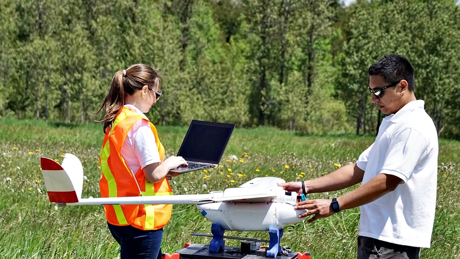
Aeromao from Canada is pleased to announce that the Aeromappers line of commercial grade drones have been added to the list of compliant UAV systems of Transport Canada. This distinction allows Canadian organizations using Aeromapper drones to apply for Compliant Operator status.
A total of four drone system models the company produces have been added to the list of compliant UAV systems for advanced operations, according to Transport Canada UAS Standard:
- Aeromapper Talon
- Aeromapper 300
- (New) Quad Mapper VTOL: fixed wing system with VTOL capabilities
- (New) Nano Mapper: sub 1Kg. fixed wing drone suited for agriculture and high affordability.
Two more variants of the Aeromapper Talon are currently awaiting confirmation from Transport Canada to be added to the list of compliant drones: Aeromapper Talon Amphibious and Aeromapper Talon LITE (a 3hr endurance version also suitable for BVLOS operations).
“Aeromao’s UAV solutions officially meet Transport Canada’s standards of safety and efficiency. We are truly excited to continue assisting Canadian and foreign customers with their drone programs, not only by ensuring that our systems continue meeting the latest regulatory policy changes but also by diversifying our line of commercial drone systems that fit all customer requirements and budgets” says Mauricio Ortiz, CEO of Aeromao.
The Aeromappers have demonstrated over the years a history of safe operation in some of the harshest environmental conditions both in Canada and other countries around the world.
For more information please visit www.aeromao.com