Site blog
Series A Funding Follows NASA Partnership, FAA Rulemaking Role and FCC Spectrum Approval to Empower the U.S. Unmanned Aircraft Systems Market
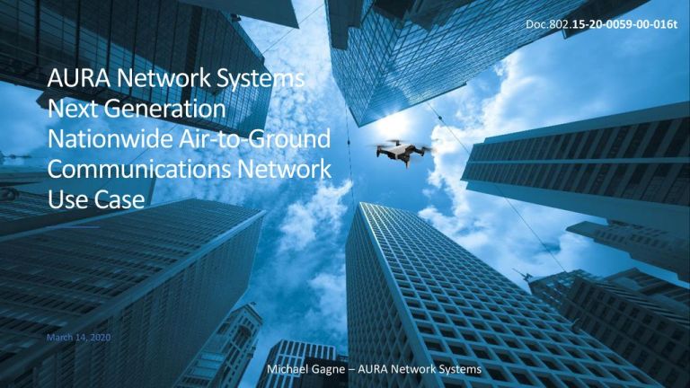
AURA Network Systems (AURA) announced today that it has closed a $30.9 million Series A funding round led by Mudrick Capital Management and Tracker Capital Management’s combined $30 million, plus nearly $1 million from company management. It is the latest milestone for the company, which operates the nation’s only coast-to-coast network designed to solve one of aviation’s most pressing problems: How to enable the commercial viability of the Unmanned Aircraft Systems (UAS) market by providing secure and reliable voice and data communications.
In addition to the Series A funding, the company earlier this month was selected by NASA as a National Campaign partner to integrate air taxies, cargo-delivery aircraft and revolutionary air-vehicle concepts into the national airspace. The NASA selection comes on the heels of the Federal Aviation Administration (FAA) naming AURA to a new fast-tracking rulemaking committee tasked with empowering beyond visual line of sight (BVLOS) aircraft operations. In turn, those milestones follow a January Federal Communications Commission (FCC) ruling that allows AURA to expand its network and foster UAS operations at all altitudes across the nation, not just the relatively low-level operations allowed today.
“Being chosen for critical FAA and NASA projects underscores AURA’s commitment to help develop a safe and efficient transportation system for both AAM [Advanced Air Mobility] and UAM [Urban Air Mobility] activities using new and highly automated aircraft – vastly different than small hobbyist drones – that will operate and transport passengers or cargo within urban, suburban and rural areas,” explained AURA CEO Bill Tolpegin.
Combined with its initial financing of $7.5 million, the latest round of funding brings the company’s total raise to $38.4 million dollars. “We’re well capitalized to advance AURA’s technology and capabilities to safely integrate higher levels of autonomy into the U.S. airspace – not only for the UAS market but also many types of manned missions.”
AURA’s leadership team has decades of experience in both the aviation and telecommunications spaces and, since the company’s inception, has been laser-focused on enabling the future of flight by expanding autonomy ranges for the aerospace industry. “We’re thrilled to be an integral part of the groundbreaking journey to transform aviation by ultimately delivering BVLOS capabilities in an FAA-compliant nationwide network for both consumers and the businesses that serve them.”
While the latest funding will be utilized for continuing commercial services for the manned aviation community, it will also support the company’s spectrum acquisition and ongoing AAM/UAM technology demonstrations with government agencies like NASA and other partners in the rapidly accelerating autonomous-aviation industry.
About AURA
AURA (which stands for Advanced Ultra-Reliable Aviation) is on a mission to deliver an FAA-compliant nationwide network utilizing a unique, licensed aviation spectrum to accelerate advanced levels of autonomy in the National Airspace System. Its vision is to empower the aerospace industry’s pioneering technology solutions that improve accessibility and safety, drive economic expansion and further environmental sustainability – while transforming the concept of aviation for manned and unmanned aircraft. AURA’s frequencies in the 450-MHz band have extraordinary propagation characteristics ideal for secure and reliable communications. The company’s technology increases the commercial viability of autonomous operations. See AURANetworkSystems.com for more information.
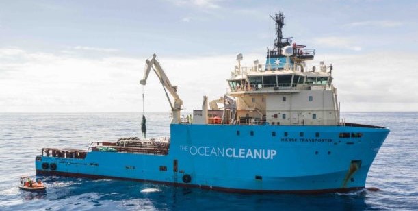
In another amazing implementation of drones for environmental protection, Oceans Unmanned and The Ocean Cleanup have joined forces to fight marine debris.
Oceans Unmanned, Inc. is a non-profit dedicated to the use of drones for environmental protection: The Ocean Cleanup, a non-profit founded in 2013 to deal with the problem of plastic and debris in the ocean. Now, the two will work together, using drones to evaluate and improve ongoing efforts to capture and remove marine debris in the Great Pacific Garbage Patch. “Later this summer, a team of Oceans Unmanned operators equipped with several UAS will deploy offshore with The Ocean Cleanup researchers for a six-week campaign to conduct daily aerial surveys in an attempt to quantify the distribution and abundance of marine debris in the target area,” says an Oceans Unmanned press release.
By: Miriam McNabbon.It is estimated that over five trillion pieces of plastic currently litter the ocean and accumulate in five ocean garbage patches, with the largest one being the Great Pacific Garbage Patch located halfway between California and Hawaii. Founded in 2013 to address this issue, The Ocean Cleanup is developing technologies to capture and retain at-sea marine debris to bring it back to shore for recycling. In July, the organization will head back out to the Great Pacific Garbage Patch to deploy the third iteration of their ocean cleanup design. The first system was deployed in 2018, and the second, improved version in 2019. “We successfully performed a feasibility assessment on UAS-based remote sensing for the quantification and detection of floating plastic in 2018,” stated Robin de Vries, The Ocean Cleanup Geospatial Analyst. “When we decided to ramp up this area of our work, we turned to Oceans Unmanned because of their years of proven maritime UAS expertis
e.
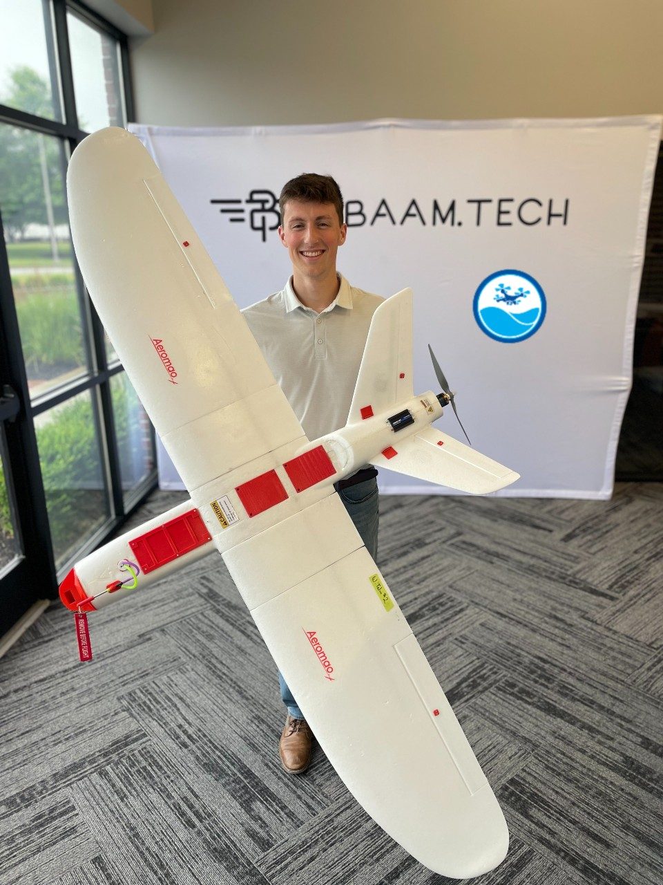
“We’re very excited about this partnership,” said Matt Pickett, Director of Oceans Unmanned. “We’ve been following the great work of The Ocean Cleanup for several years, and we’re looking forward to supporting their efforts. We’re big believers in the power of technology to address longstanding environmental challenges and marine debris is an area where we think we can make a big impact.” The waterproof Aeromao Talon Amphibious UAS will be launched from the ship, survey for approximately two hours, then perform a water landing and be recovered by a small boat. Imagery captured by the UAS will be analyzed through an automated neural network for object detection which can direct on-site collection efforts and evaluate recovery system efficiency.”
“We will be operating over 1000 miles offshore, and a UAS is the perfect tool to help analyze this global problem,” CAPT Brian Taggart, NOAA (ret), Director, Oceans Unmanned, tells DRONELIFE. “We hope to make an impact!”
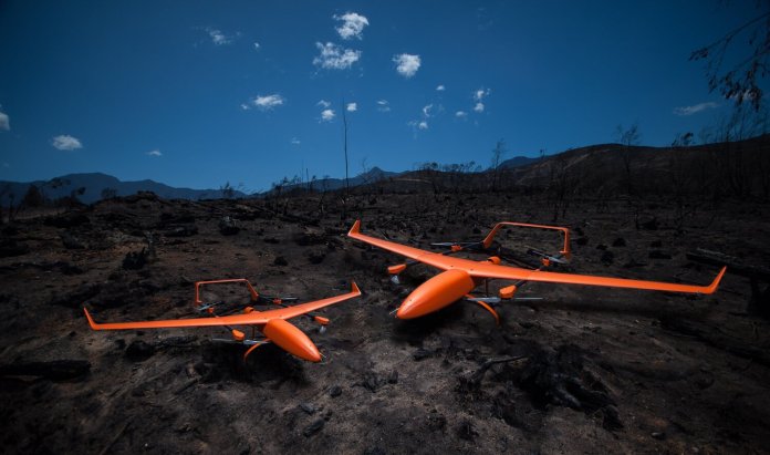
Silvus Technologies, Inc. (“Silvus”) today announced the company has been selected as ALTI UAS’ (“ALTI”) primary radio, providing high-quality video and flight data for all medium and large unmanned aircraft. The radios were selected for their proven performance at extended ranges and their ability to reliably maintain a data link in austere environments – an essential requirement due to the surveillance and security applications of ALTI’s aircraft. “As a leading VTOL unmanned aircraft manufacturer, we are constantly improving the quality of our platforms,” said Duran De Villiers, Director of ALTI.
“After extensive testing, Silvus radios excelled at greater ranges than all other radios that we tested. Silvus’ performance, coupled with the hardware quality and functionality of the radios, is a critical addition to our platform and brings tremendous value to our customers,” added Development Manager Jaco Horn.
StreamCaster radios, which ALTI has previously used for demonstration and development platforms, were also selected for their sophisticated eigen beamforming technique. As ALTI continues the development of their largest aircraft and corresponding data link, StreamCaster radios will be essential to maintaining the same level of performance and reliability at extended ranges.
“We strive to provide a single-radio solution for the toughest unmanned systems communications scenarios,” said Jimi Henderson, Silvus Vice President of Sales. “ALTI is a leader in the unmanned space, and we are proud to be selected as the primary radio for their aircraft, delivering unrivaled performance and unmatched range.”
About Silvus Technologies, Inc.Privately held and headquartered in Los Angeles, Silvus Technologies develops advanced MIMO technologies that are reshaping broadband wireless connectivity for mission-critical applications. Backed by an unmatched team of PhD scientists and design engineers, its technologies provide enhanced wireless data throughput, interference mitigation, improved range, mobility, and robustness to address the growing needs of its government and commercial customers.
About ALTIALTI is an industry-leading, award-winning unmanned aircraft manufacturing company operating out of Knysna, South Africa, focusing on long-range and endurance vertical take-off and landing unmanned aircraft. ALTI aircraft are designed to fly multiple payloads, complete smart autonomous flight missions and provide the situational awareness needed for demanding security & surveillance operations. For more information, visit www.altiuas.com.
By PRESS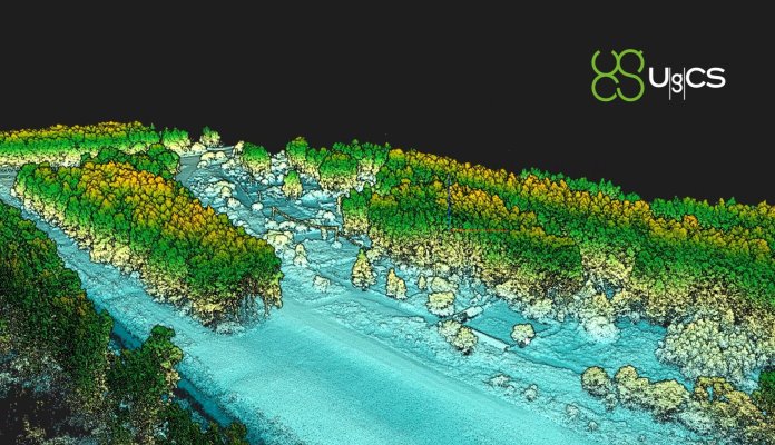
Riga, Latvia – July, 2021 – SPH Engineering announces the release of UgCS update, introducing LIDAR toolset to unlock the full potential of LIDARs making remote sensing most effective with no human errors. Key features include precise calibration, flight patterns for route planning, anti-shake turns, and constant line spacing and buffer.
UgCS LIDAR toolset allows to optimize time and cost-effectiveness at all stages of data collection and processing. At the flight planning stage time could be saved on mission planning with flight patterns and turns designed specifically for LIDAR surveys. At the flight stage one may acquire high-quality laser data with preset IMU initialization patterns and anti-shake LIDAR turns. During post-flight data analysis, the high accuracy of acquired data ensures getting desired results with one trip to the field and better data analysis.
‘We have received various requests from LIDAR producers and end-users to improve the accuracy of laser data collected with a UAV. We have invested in UgCS R&D to focus mainly on automated IMU calibration commands, automatic calculation of required line spacing and overlap; and prevention of sensor shaking. Trial flights over SPH Engineering’s in-house test range have confirmed UgCS LIDAR toolset capacity to support main LIDAR market players’, Alexei Yankelevich, head of software development at SPH Engineering, comments.
Based on the task, common application areas may include but not be limited to power line inspections, road inspections, construction, mining, archaeology, forestry.
To learn how the technology works visit https://www.ugcs.com/lidar
About SPH Engineering
SPH Engineering (sph-engineering.com) is a multiproduct drone software company and UAV integration services provider. Founded in 2013 in Latvia (EU) as a UAV mission planning and flight control start-up, the company has evolved from a developer of a single flagship product (UgCS) to a market leader of multiple drone solutions. Today, the company boasts a rich global customer and reseller network in 150+ countries, while over 45% of partners are located in North America. To provide high-quality solutions for UAV professionals, SPH Engineering’s team advances four key product lines: UgCS (mission planning and flight control software), UgCS Integrated Systems (airborne integrated systems with sensors from diverse manufacturers), Drone Show Software (only commercially available software to manage drone swarm flights) and ATLAS (AI platform to process and analyze geospatial data).
By PRESS
Area of eastern Manitoba now under a travel ban, forest fires continue to burn under extremely dry condition
The Manitoba Wildfire Service says the drone was flown by someone on the south shore of West Hawk Lake on Saturday, but the person wasn't spotted in the crowd of beach-goers. People who fly drones near active fires could face charges. (Digital Timber web page)
A water bomber trying to put out a forest fire in eastern Manitoba had to turn back after someone flew a drone in its way, according to the province.
It happened on Saturday as the plane was en route to douse the flames of a fire in Whiteshell Provincial Park near the Ontario border. The water bomber was flying over the south shore of West Hawk Lake when a drone got in the way of its flight path.
The water bomber had to turn back, leaving the firefighters on the ground in jeopardy.
"That could have turned into something way worse than it was, just because someone flew a drone," said Don Hallett, assistant director for the Manitoba Wildfire Service. "Thankfully the ground crews were able to do what we needed them to do."
The province says there were many people on the beach, but the person flying the drone wasn't spotted.
"Just take your communities into consideration and your fellow Manitobans into consideration," Hallett said.
He says people who fly drones near active fires could face charges. Anyone who witnessed the incident is asked to contact Falcon Lake RCMP.
Residents in part of eastern Manitoba 'must be ready to leave'
Extremely dry conditions continue to hamper efforts to control wildfires. Most of Manitoba remains under a fire ban, including provincial parks and most municipalities, including Winnipeg.
Starting Tuesday morning, additional restrictions will be in place for an area near the Ontario border.
A full travel ban will kick in for the Wildfire Service's Area 4 — which encompasses the large area north of the Wanipigow River, east of Lake Winnipeg to the Ontario border including Atikaki Provincial Park and north to Poplar River.
The province says there will be no access to cottages, and permanent residents must be ready to leave on an hour's notice.
There are 130 forest fires burning right now in Manitoba, including about two dozen the province lists as out of control.
Most of the current fires were started by natural causes like lightning strikes, Hallett said.
By Marina von Stackelberg · CBC News
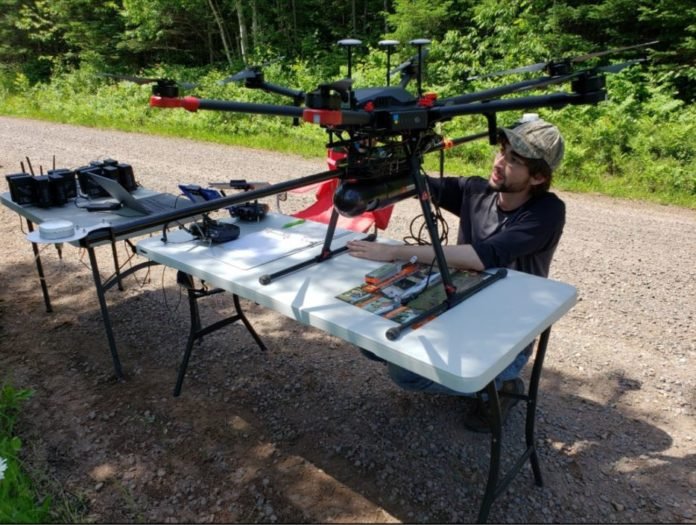
A specialist team at the University of Wisconsin-Madison (UW-Madison) used the Routescene UAV LiDAR system to detect and visualize forests in Northern Wisconsin, USA as part of the CHEESEHEAD project. The objective of this wider project is to improve weather forecasting by understanding further how vegetation and forests influence the atmosphere. This information will be used by decision-makers to develop policies that more effectively enable carbon emission reductions.
CHEESEHEAD project overview
The aim of the CHEESEHEAD project (The Chequamegon Heterogeneous Ecosystem Energy-balance Study Enabled by a High-density Extensive Array of Detectors) is to study interactions and feedbacks between the land surface and atmosphere and how these results can be used to improve weather and climate models. Ultimately the results will enable better carbon emission reduction policymaking.
The UW-Madison team collected high-density 3D point cloud data of the prominent tree species in the Chequamegon-Nicolet National Forest, USA. Routescene’s LiDAR system mounted on a drone can capture the full tree structure from the tree canopy to the vegetation at ground level. This survey was part of a wider project to understand how water, heat and carbon interact across a variety of landscapes like forests.
The UAV LiDAR surveys
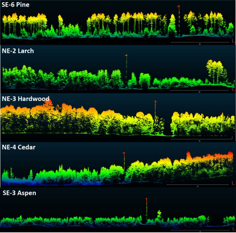
UAV LiDAR is ideal to quickly and efficiently survey and represent the type, shape and composition of the forest canopy. Surveys were carried out around eleven 100ft flux towers within areas that ranged from 0.25 to 1km². Six forest types were identified which included Aspen, Pine, Poplar, Larch, Cedar and Hardwood.
Christian Andresen from the University of Wisconsin-Madison commented, “The tall canopy of 20-30m height created difficult flying conditions. It was difficult to keep a visual line of sight, so we decided to fly smaller 500 x 500m flights to keep sight of the drone.”
The Routescene LiDAR system includes a 32-laser LiDAR sensor providing a scan rate of up to 1.4 million points per second. Point cloud density averaged 600 points per meter squared with a vertical accuracy of 2-5cm.
Christian added, “The Routescene system worked flawlessly we achieved all we had planned. Over the 3 days our crew of two covered a total of 4.2 km². We were particularly impressed with the density of overlapping flight lines and the mapping of the forest structure.”
Summary
This study was the first to use a UAV LiDAR system to characterize the forest structure by tree type in Northern Wisconsin. The project contributed to the wider CHEESEHEAD experiment to generate knowledge that advances the science of surface flux measurement and modelling, relevant to many scientific applications such as numerical weather prediction, climate change, energy resources and computational fluid dynamics.
For more information please visit www.routescene.com more information about this case study can be found here
By PRESS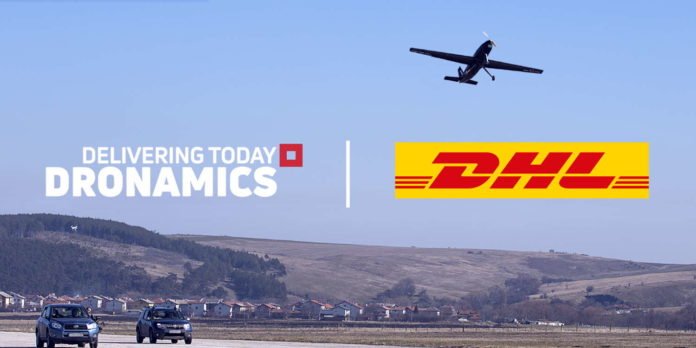
DRONAMICS, the world’s leading middle-mile cargo drone developer and operator, today unveiled a partnership agreement with the world’s number one logistics company, DHL.
DHL will partner DRONAMICS to jointly develop solutions and offer same-day cargo drone deliveries to customers using DRONAMICS’ drone delivery network and Black Swan drones. Both companies are discussing mutual exclusivity for middle-mile drone deliveries in selected industries and markets. In addition, DRONAMICS’ goal to become carbon-negative by 2027 and direction to operate on sustainable biofuels in the future will play a part in helping DHL achieve its goal of becoming carbon neutral by 2050.
“Innovation is a key part of DHL’s DNA. We are constantly exploring new technologies to bring value to our customers, and we believe that cargo drones will be an element in the next generation of transportation in logistics. DRONAMICS is a pioneer and leader in the field of cargo drones and our collaboration will help to open up opportunities for urgent, sensitive and time-critical deliveries. We are excited to pilot the use of the Black Swan in customer operations in the near future,” says Matthias Heutger, Senior Vice President, Global Head of Innovation & Commercial Development at DHL.
“We are incredibly excited that DRONAMICS has been selected by DHL, the world’s largest logistics provider as their first middle-mile drone partner, with a partnership that provides mutual exclusivity in selected industries and markets. This partnership has the potential to generate €1.86 Bn to DRONAMICS’ revenues annually, with plans underway to build and operate over 4,000 cargo drones to support the partnership in the coming years,” says Svilen Rangelov, Co-Founder and CEO of DRONAMICS.
The partnership aims to combine DRONAMICS middle-mile cargo drones with DHL’s first and last-mile services. As part of the agreement, DRONAMICS will provide equipment and expertise to operate the unmanned drone flights, employing staff in handling and technical roles. The first commercial flights of the same-day drone cargo services are expected to begin in 2022.
About DRONAMICS: Based in London (UK) and Sofia (Bulgaria), DRONAMICS is the world’s leading developer and operator of large cargo drones. Its flagship Black Swan unmanned aircraft is able of carrying 350 kg of cargo over a distance of up to 2,500 km at up to 80% lower cost than any aircraft in existence, enabling same-day shipping over very long distances for e-commerce, pharma, and time-critical shipments.
Founded in 2014 by the Rangelov brothers, an economist and an aerospace engineer, the company’s fast-growing team includes some of the world’s top aerospace and logistics experts and is the winner of numerous awards for innovation, including IATA’s Drone Innovation Award.
About DHL:
DHL – The logistics company for the world
DHL is the leading global brand in the logistics industry. Our DHL divisions offer an unrivalled portfolio of logistics services ranging from national and international parcel delivery, e-commerce shipping and fulfillment solutions, international express, road, air and ocean transport to industrial supply chain management. With about 400,000 employees in more than 220 countries and territories worldwide, DHL connects people and businesses securely and reliably, enabling global sustainable trade flows. With specialized solutions for growth markets and industries including technology, life sciences and healthcare, engineering, manufacturing & energy, auto-mobility and retail, DHL is decisively positioned as “The logistics company for the world”.
DHL is part of Deutsche Post DHL Group. The Group generated revenues of more than 66 billion euros in 2020. With sustainable business practices and a commitment to society and the environment, the Group makes a positive contribution to the world. Deutsche Post DHL Group aims to achieve zero-emissions logistics by 2050.
By PRESS
Today, leading public safety technology company Carbyne announces its integration with Edgybees, a provider of high-precision, geo-registration software for aerial video that improves response time, accuracy, and communications for first responders during emergencies. The partnership brings video imagery to 911 call centers, public safety decision makers, and first responders in real-time through drone footage, enabling them to assess situations and efficiently respond based on precise video of the area in crisis.
Cities across the country are rapidly deploying innovative solutions, including drones, to aid in disaster response and overhaul the emergency response system – ultimately reducing time to dispatch and saving lives. Edgybees’ AI-centric software solution, in combination with Carbyne’s 911 unmatched video capabilities, improves situational awareness for emergency responders in dangerous circumstances such as wildfires, floods, or earthquakes. Expanding on Carbyne’s existing data set, Edgybees’ technology delivers real-time video augmented with high-precision geographical registration from any drone, which is then transmitted into any application gateway connector.
Through this integration, Carbyne can receive footage from any connected drone and stream it directly to the 911 call center, not only giving dispatchers and first responders an aerial view of the territory, but also providing additional key data points such as specific street names or traffic lights to pinpoint the exact location of the disaster. This unique approach generates real-time, detailed overlays of roads, key landmarks, and other mission-critical data on top of live video feeds, enabling defense, public safety, and critical infrastructure teams to accomplish lifesaving and high-urgency missions quickly and safely.
“The vulnerabilities of our emergency response system have continually revealed themselves over the past year, and it’s evident the outdated system requires improvements that will save more lives and simplify the method overall,” said President and COO of Carbyne, Erez Tsur. “Technological advancements in emergency response, such as the incorporation of real-time video or even drone capabilities, are streamlining mission-critical operations like never before. Carbyne is eager to partner with Edgybees to elevate our platform’s accuracy, improve life-saving measures, and achieve unprecedented location precision in the face of danger or disaster.”
“Adding real-time video augmented with accurate geo-location of roads and key landmarks delivers a new level of visibility to response centers using the Carbyne emergency collaboration platform. It provides accurate situational analysis to first responders, dramatically increasing their ability to save lives during natural disasters, search and rescue missions, and other emergency response operations,” stated Adam Kaplan, CEO and co-founder of Edgybees. “The Edgybees platform has been battle-tested in major public emergency situations, including wildfires in Australia and California and major category 5 hurricanes. We look forward to our collaboration with Carbyne to help advance public safety teams.”
To learn more, please visit www.carbyne911.com
About Carbyne
Carbyne is a global leader in public safety technology. Headquartered in NYC, Carbyne quickly grew to be one of the dominant global players in the public safety global industry. Today, Carbyne is the largest rich-data provider globally, delivering over 155M data points per year. In addition, its rich data platforms enable first responders and Emergency Call Centers to connect with the caller via highly secure communication omni-channel with no app required. With a mission to redefine emergency collaboration, Carbyne provides a unified cloud native solution that enables ECCs, first responders, citizens and the state to share live actionable data that can lead to more efficient, transparent operations and ultimately save lives. For more information visit www.carbyne911.com
About Edgybees
Founded in 2017, Edgybees brings clarity, accuracy, and speed to mission-critical and lifesaving operations that rely on streamed aerial video for situational awareness. Edgybees’ solution combines advanced computer vision and machine learning technologies to accurately match aerial video to satellite reference imagery in real-time. This unique approach enables rapid decision-making by visually augmenting roads, key landmarks, and other mission-critical data on top of live video feeds – via our own platform or by integrating with third-party virtual augmentation solutions. With high-precision geo-tagging and near-zero latency, Edgybees makes complex operational environments instantly clear – enabling defense, public safety, and critical infrastructure teams to accomplish lifesaving and high-urgency missions quickly and safely. For more information visit www.edgybees.com
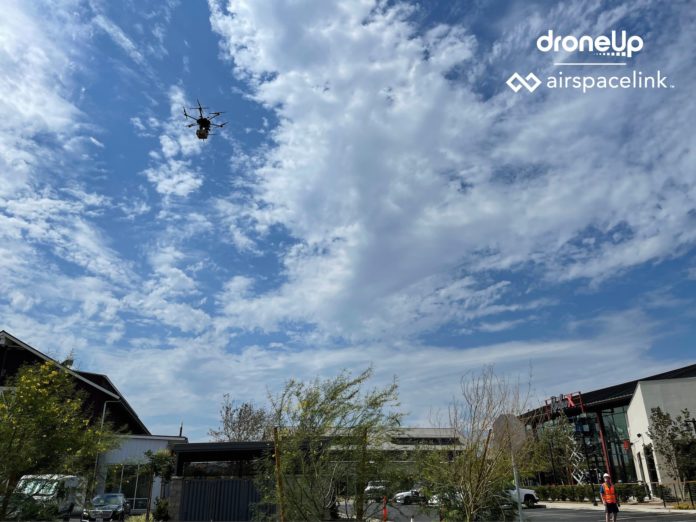
DroneUp announced today that they completed the first smart city drone delivery in Ontario, CA, with Brookfield Properties at New Haven. Other firsts for the residents of Ontario and the New Haven masterplan community included robot carts, e-scooters, and smart hubs. These smart city breakthroughs come as New Haven unveils major retail openings at New Haven Marketplace.
The technology advancements result from long-term investment by the City of Ontario and Brookfield Properties, which further define the city as one of the most progressive in the U.S., providing technology that vastly improves everyday life for residents. New Haven is the fastest growing community in California and 5th in the U.S.
DroneUp, along with drone software leader Airspace Link, worked to bring drone delivery from New Haven Marketplace businesses and services directly to residents via drone. Following these test trials, Ontario and New Haven plan to offer the first authorized drone flights in this large California city. These will also be the first flights near a major airport (Ontario International Airport) and the first drone flights with direct city involvement.
Ontario Mayor Paul S. Leon said, “The New Haven masterplan debuted in 2015 as a ‘gigabit community,’ with lightning-fast downloads far surpassing other cities in the country. Since then, our partnership with Brookfield Residential has continued to deliver the best, most cutting-edge, and practical technology. It’s all about Community, Connectivity, and Convenience. And these new tools – enhancing and simplifying life at New Haven – boost sustainability and businesses while propelling Ontario among the nation’s top, smart-technology cities.”
“We are pleased to see the leadership in Ontario ensure their community has the right safety procedures in place and is ready to support advanced commercial drone operations,” said Michael Healander, CEO of Airspace Link. “Brookfield Properties recognizes a need for greater connectivity and convenience with residential homes and populations migrating out of downtown urban environments and into more rural and suburban environments.”
“Drones are the future of developing smart cities. This is particularly true for residential and retail developments seeking to create an ecosystem where engaging drones can advance connecting people to services with speed and convenience, eliminating traffic while also offering sustainable and greener options for receiving goods and services,” stated Tripp Shannon, CRO of DroneUp, “Ontario is forward-thinking. We are pleased to support their testing initiative to streamline city operations so that city planners can improve their understanding of how communities work together using technology.”
About DroneUp
DroneUp is recognized as a drone flight services innovation leader, transforming organizations with drone delivery and drone technology solutions. DroneUp develops SaaS platforms having patented mobile app technology available at the Apple App and Google Play Stores. With technology-driven customers, together they inspire the future of drone services, providing intelligent access to airspace, automation innovation, streamlined process management, operational efficiency, and a commitment to safety.
Headquartered in Virginia Beach, Virginia, DroneUp was founded in 2016 by Tom Walker. DroneUp quickly moved from an American small business start-up to a global leader, receiving a significant investment from the #1 retailer in the world, Walmart, Inc. DroneUp, a privately held company, works with more than 20,000 drone pilots to serve its customer portfolio and is dedicated to connecting communities to drone technology globally. For more information: https://www.droneup.com.
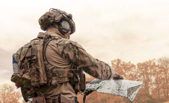
Weighing just 1.6 kg (3.5 lbs), eBee TAC is an ultra-portable solution delivering up to 90 minutes of flight time and 500 ha (1,236 A) of coverage ideal for mid- to long-range mapping and scouting missions
Features enhanced operational security with AES-256 radio data link encryption, drone log file suppression, silent radio mission plus data and communications control
Fully operational in disconnected environments with the capability to integrate with situational awareness tools such as ATAK
eBee TAC is fully National Defense Authorization Act (NDAA) compliant
CHESEAUX-SUR-LAUSANNE, Switzerland, July 2021 – senseFly, the global leader in fixed-wing mapping drones, today announces the launch of eBee TAC, an advanced fixed-wing Unmanned Aircraft System (UAS) optimized for covert tactical mapping operations in defense, security and governmental sectors. The eBee TAC offers active field personnel access to accurate and reliable location data and maps, delivering the field intelligence and situational awareness needed to act with confidence and precision across rapidly-changing environments. More importantly, the eBee TAC is fully National Defense Authorization Act (NDAA) compliant.
At just 1.6 kg (3.5 lbs), eBee TAC is a lightweight, ultra-portable and robust solution specially designed for tactical mapping and analysis in defense applications and its product platform is currently employed by U.S. forces. With up to 90 minutes of flight time and a single flight coverage of up to 500 ha at 122m (1,236 A at 400 ft.), it is ideal for long-range Beyond Visual Line of Sight (BVLOS) operations, with the capability to integrate with situational awareness tools such as ATAK.
Adding to powerful flight and integration capabilities, eBee TAC includes enhanced security features to protect field operations. The included eMotion flight and mission planning software enables operations in disconnected environments and employs Advanced Encryption Standard 256[1] (AES-256) to prevent communications hacking between the UAS and its control station. Silent radio mission mode can be activated to minimize UAS detection during flights, while a No Log Mode suppresses flight recordings.
The eBee TAC features a unique digital camouflage (“digicam”) skin for increased stealth during missions and can be rapidly deployed from assembly to hand-launch in just three minutes and operated by one person in the field for added agility. Its included backpack offers durable protection and portability for the UAS and its components between locations.
With its mission-directed suite of swappable sensors, eBee TAC allows operators to collect thermal, Normalized Difference Vegetation Index (NDVI) and RGB data that can be immediately used via the on-board SD card for analysis and rapid decision-making. This aerial data can be processed using photogrammetry software to generate high-resolution topographic maps and 3D models of landscape terrain, high-value points of interest and other outputs which provide enhanced situational awareness.
“Traditional mapping tools, such as quadcopters or short-range surveillance drones, lack the capabilities to perform mid-range mapping reconnaissance tasks, particularly in environments that are difficult to navigate,” comments Benjamin Pinguet, Product and Solution Manager at senseFly. “Together with our partner, Tough Stump Technologies, we have listened to the needs of field personnel to ensure that the eBee TAC is purpose-built for the tactical mapping demands of defense applications. We’re confident that this is the best product to suit their needs.”
senseFly recently announced its distribution partnership with Tough Stump Technologies, a veteran-owned business based in North Carolina, USA, specializing in remote sensing, situational awareness and mobile communications. The eBee TAC is offered to U.S. customers as part of its ARTEMIS (Aerial Reconnaissance Tactical Edge Mapping Imagery System) solution, alongside the eBee X and senseFly’s extensive portfolio of UAS sensors, to suit a range of tactical mapping operations. It can also be purchased as a standalone product directly from senseFly.
Jarrett Heavenston, co-founder/CEO at Tough Stump Technologies adds, “senseFly is unique and their global network means we can count on them for support anywhere in the world. We’re learning a lot from each other, helping to push the boundaries of technology and make fixed-wing UAS an essential tactical mapping tool for government agencies in the field.”
As with all senseFly professional UAS, eBee TAC customers receive access to senseFly’s global distribution network of customer and technical support, its team of in-house experts and an extensive library of online training resources, including the newly launched e-Learning Training Platform and senseFly Certified Operator Program.
For more information on the eBee TAC, as well as senseFly’s wider product portfolio, visit www.sensefly.com. To find out more about the ARTEMIS solution, visit www.toughstump.com.
ABOUT SENSEFLY
At senseFly, we believe in using technology to make work safer and more efficient. As the global leader in fixed-wing drones, our proven drone solutions simplify the collection and analysis of geospatial data, allowing professionals in surveying, agriculture, engineering, and humanitarian aid to make better decisions, faster. The company is a commercial drone subsidiary of Parrot Group
By PRESS